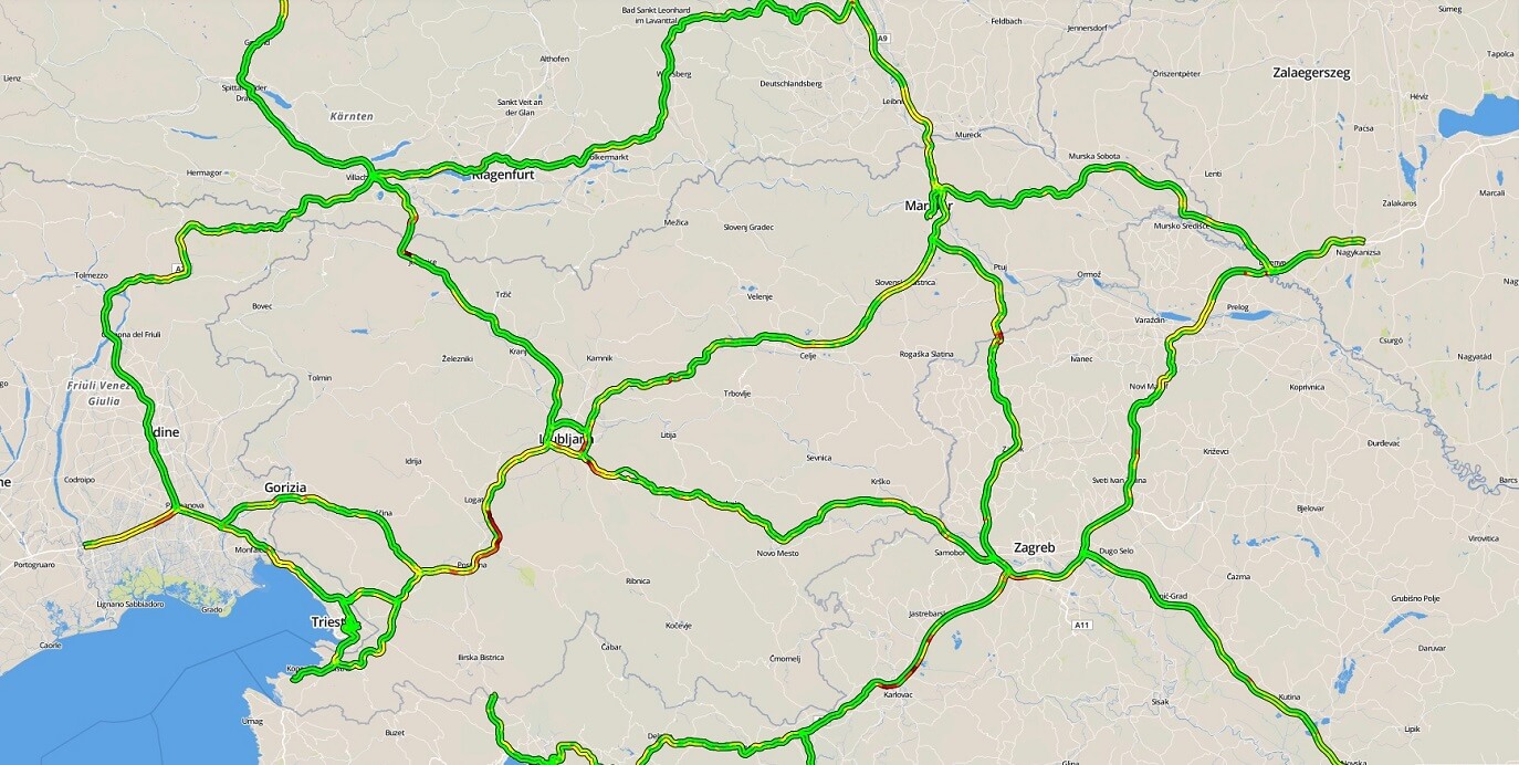
The traffic platform ensures the highest quality of traffic information. It includes different components for traffic monitoring, a central traffic database, traffic APIs, and other services for building applications.
Traffic platform is based on Floating Car Data (FCD) patented technology that collects and processes information of moving vehicles on the road. It anonymously and continuously monitors the location and speed of vehicles equipped with GPS connected devices. Based on this data it constructs and matched traffic flow on a roadmap background.
One of the most recognizable and useful functionalities is real-time traffic flow information. The system aggregates data on actual speed, travel time, and time delay based on individual road segments.
The data is updated every 60 seconds:
- Actual speed and travel times on individual road segments
- Service threshold and absolute speed
- Traffic flow colour labelling based on actual speed
Traffic platform also automatically detects traffic jams based on the measured speed. These traffic jams are than translated into different warning codes such as “Traffic jam between point X and Y with the measured average speed of 10 km/h”. Additionally, to detecting traffic jams the platform can detect and label other events such as accidents, roadworks, obstacles on the road, police checks, etc. These events are entered into the system via traffic operators or via alternative connected traffic sources.
A roadmap is also a big part of the traffic platform, which is based on the technology of a cartography server. Besides the existing layers such as OpenStreetMap, GoogleMaps or MonolitMap it also shows the speed of traffic flow marked by different colours and other traffic events marked by different icons.
The 2 layers of the Traffic platform
- Traffic flow layer: the colours mark the measured speed
- Traffic event layer: icons marks the specific event (traffic jam, accident, roadwork, etc.)
The map allows the following functionalities:
- The ability to zoom in and zoom out: different layers show depending on the zoom
- The ability to geocode by clicking on the map: As a base for the starting and finish point of the route
- The ability to show the route based on route calculation: As a shape file


